Fields of application:
Three-dimensional, high detailed simulations of landscape’s large areas, with associate possible interaction with real data. Planning of: environmental restoration, parks, public lands management, big scale vehicle’s traffic. Interactive tourist trails and hiking.
Description:
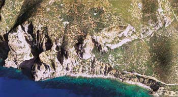
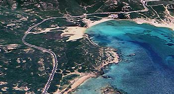
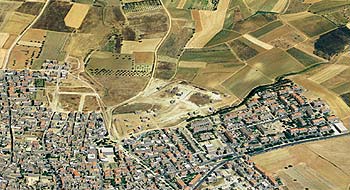
Territorial models based on advanced mapping with ortophoto aerophotogrammetric texturing.
Ability to create a bird's eye guided tours, interactive real-time 3D navigation with the option to display data for places of interest. The models are built taking into account detailed terrain information, buildings and roads.
Media delivery:
Available in real-time 3D models in Adobe 3D PDF or other 3D interactive formats.
Video montages of specific paths inside 3D models or Video documentaries.
Rendering, illustration, photo-inserts, and products optimized for printing on large format.
Real-time 3D interactive tour is available on-line directly on the web (using plug-ins), and off-line (using Executable WIN or MAC).
Some products made in this area:
Mining areas of Montevecchio-Piscinas.
3D simulation of the road Maracalagonis-Burcei.
Three-dimensional reconstruction of the area of Villasimius.
Reconstruction of the entire municipality of Settimo San Pietro.