Project
3D Historical Reconstruction of City of Cagliari
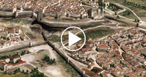
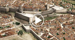
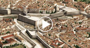
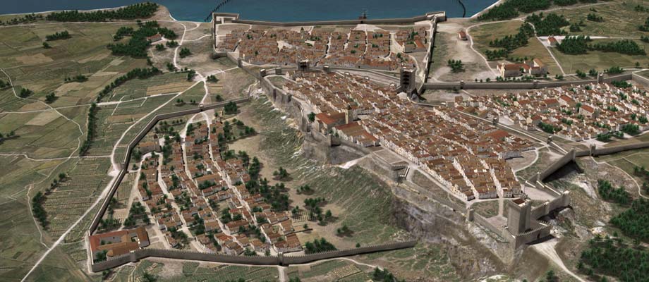
The project consists of a three-dimensional reconstruction of the historic city of Cagliari and its fortifications, into three distinct periods fifteenth, sixteenth and eighteenth century.
The project was carried out in close collaboration with the architect M.Beatrice Artizzu, scholar with an in depth knowledge of the City of Cagliari and expert on ancient maps. This collaboration, together with data extracted from aerophotogrammetric maps in scale1:500 has allowed the creation of a hypothetical 3D reconstruction of the fortifications and their evolution over time.
More details follow in the description.
Project steps:
- Photographic survey.
- Optimization of the 1:500 map.
- Map transformation in triangulated mesh.
- Optimization of the mesh.
- 3D model creation & texturing.
- Insertion of vegetation.
- Representation of rural areas inside and outside the city walls.
- Creation of a video for each of the three periods.
- High-resolution illustrations from four different points of view.
- Compiling historical and technical report of the project.